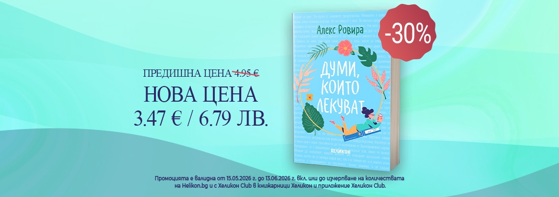

 -30%
-30%

Рейтингът се формира от продажбите в системата на Хеликон
Гори за мен - Кн.1 Скрито наследство
Илона Андрюс
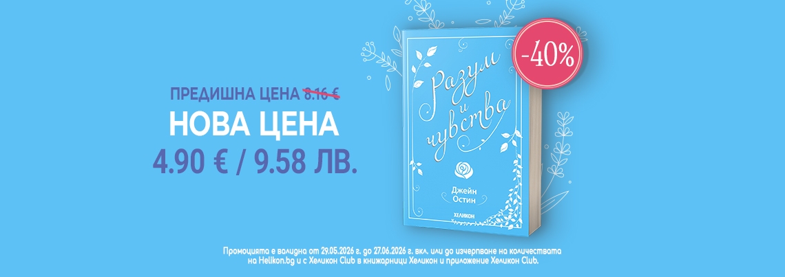
14.83 € / 29.00 ЛВ.
Отстъпка -30%
Отстъпка -30%
10.38 € / 20.30 ЛВ.
-30%

Рейтингът се формира от продажбите в системата на Хеликон
Нобел. Загадъчният Алфред. Неговият свят и неговите награди
Ингрид Карлберг
16.87 € / 32.99 ЛВ.
Отстъпка -30%
Отстъпка -30%
11.80 € / 23.08 ЛВ.
-30%

Рейтингът се формира от продажбите в системата на Хеликон
Наситени митове
Д-р Идрис Мугал
10.23 € / 20.01 ЛВ.
Отстъпка -30%
Отстъпка -30%
7.16 € / 14.00 ЛВ.
-30%

Рейтингът се формира от продажбите в системата на Хеликон
Бъди по-щастлив сега
Джейкъб Сейгър Уайнстийн
9.20 € / 17.99 ЛВ.
Отстъпка -30%
Отстъпка -30%
6.44 € / 12.60 ЛВ.
-30%

Рейтингът се формира от продажбите в системата на Хеликон
Автобиография. Пътят към богатството
Бенджамин Франклин
8.16 € / 15.96 ЛВ.
Отстъпка -30%
Отстъпка -30%
5.71 € / 11.17 ЛВ.
-30%

Рейтингът се формира от продажбите в системата на Хеликон
Изкуството да владееш себе си
Владимир Леви
9.71 € / 18.99 ЛВ.
Отстъпка -30%
Отстъпка -30%
6.79 € / 13.28 ЛВ.
-30%

Рейтингът се формира от продажбите в системата на Хеликон
C++ на разбираем език
Брайън Овърленд
12.78 € / 25.00 ЛВ.
Отстъпка -30%
Отстъпка -30%
8.94 € / 17.49 ЛВ.
-30%

Рейтингът се формира от продажбите в системата на Хеликон
Господин Ибрахим и цветята на Корана
Ерик-Еманюел Шмит
5.11 € / 9.99 ЛВ.
Отстъпка -30%
Отстъпка -30%
3.57 € / 6.98 ЛВ.
-30%

Рейтингът се формира от продажбите в системата на Хеликон
Юнгианска анализа на сънищата
Джеймс Хол
6.14 € / 12.01 ЛВ.
Отстъпка -30%
Отстъпка -30%
4.29 € / 8.39 ЛВ.
-30%

Рейтингът се формира от продажбите в системата на Хеликон
Вино от глухарчета
Рей Бредбъри
10.22 € / 19.99 ЛВ.
Отстъпка -30%
Отстъпка -30%
7.15 € / 13.98 ЛВ.
-25%

Рейтингът се формира от продажбите в системата на Хеликон
Винаги ти - Кн.3 от поредицата "Семейство Адар"
Саманта Йънг
12.78 € / 25.00 ЛВ.
Отстъпка -25%
Отстъпка -25%
9.58 € / 18.74 ЛВ.
-25%

Рейтингът се формира от продажбите в системата на Хеликон
Къщата отвъд езерото
Райли Сейгър
12.27 € / 24.00 ЛВ.
Отстъпка -25%
Отстъпка -25%
9.20 € / 17.99 ЛВ.
-25%

Рейтингът се формира от продажбите в системата на Хеликон
The Love Code
Susannah Nix
12.76 € / 24.96 ЛВ.
Отстъпка -25%
Отстъпка -25%
9.57 € / 18.72 ЛВ.
 -25%
-25%

Рейтингът се формира от продажбите в системата на Хеликон
Островът на избавлението
Патриша Уилсън
12.78 € / 25.00 ЛВ.
Отстъпка -25%
Отстъпка -25%
9.58 € / 18.74 ЛВ.
-25%

Рейтингът се формира от продажбите в системата на Хеликон
Медитация: Практическо ръководство
Свами Рама
5.11 € / 9.99 ЛВ.
Отстъпка -25%
Отстъпка -25%
3.83 € / 7.49 ЛВ.
-25%

Рейтингът се формира от продажбите в системата на Хеликон
Силата на сянката Кн.4 от Колелото на времето
Робърт Джордан
14.31 € / 27.99 ЛВ.
Отстъпка -25%
Отстъпка -25%
10.73 € / 20.99 ЛВ.
-25%

Рейтингът се формира от продажбите в системата на Хеликон
Древната тайна на цветето на живота Т.1
Друнвало Мелхизедек
11.25 € / 22.00 ЛВ.
Отстъпка -25%
Отстъпка -25%
8.43 € / 16.49 ЛВ.
-25%

Рейтингът се формира от продажбите в системата на Хеликон
Български народни обичаи и вярвания/ мека корица
Рачо Славейков
10.20 € / 19.95 ЛВ.
Отстъпка -25%
Отстъпка -25%
7.65 € / 14.96 ЛВ.
-25%

Рейтингът се формира от продажбите в системата на Хеликон
Думи с ритъма на вечност
Рабиндранат Тагор
30.68 € / 60.00 ЛВ.
Отстъпка -25%
Отстъпка -25%
23.01 € / 45.00 ЛВ.
-20%

Рейтингът се формира от продажбите в системата на Хеликон
Наследницата
Рейчъл Хокинс
11.25 € / 22.00 ЛВ.
Отстъпка -20%
Отстъпка -20%
9.00 € / 17.60 ЛВ.
-20%

Рейтингът се формира от продажбите в системата на Хеликон
Пак си помисли
Харлан Коубън
12.27 € / 24.00 ЛВ.
Отстъпка -20%
Отстъпка -20%
9.81 € / 19.19 ЛВ.
-20%

Рейтингът се формира от продажбите в системата на Хеликон
Кой, а не как
Дан Съливан; Бенджамин Харди
7.67 € / 15.00 ЛВ.
Отстъпка -20%
Отстъпка -20%
6.13 € / 11.99 ЛВ.
-20%

Рейтингът се формира от продажбите в системата на Хеликон
Усмивката на Катерина, майката на Леонардо
Карло Вече
12.76 € / 24.96 ЛВ.
Отстъпка -20%
Отстъпка -20%
10.20 € / 19.95 ЛВ.
-20%

Рейтингът се формира от продажбите в системата на Хеликон
Кодово име „Мадлен"
Артър Дж. Магида
10.17 € / 19.89 ЛВ.
Отстъпка -20%
Отстъпка -20%
8.13 € / 15.90 ЛВ.
-20%

Рейтингът се формира от продажбите в системата на Хеликон
Любов: Мъжът и жената. Законът на любовта
Петър Дънов
11.25 € / 22.00 ЛВ.
Отстъпка -20%
Отстъпка -20%
9.00 € / 17.60 ЛВ.
-20%

Рейтингът се формира от продажбите в системата на Хеликон
Визуалният образ. Докторантски семинар 2006-2007 + CD
7.67 € / 15.00 ЛВ.
Отстъпка -20%
Отстъпка -20%
6.13 € / 11.99 ЛВ.
-20%

Рейтингът се формира от продажбите в системата на Хеликон
Ръководство по обща и молекулярна цитогенетика
Севдалин Георгиев и др.
7.67 € / 15.00 ЛВ.
Отстъпка -20%
Отстъпка -20%
6.13 € / 11.99 ЛВ.
-20%

Рейтингът се формира от продажбите в системата на Хеликон
Дамга за обич: Маришки притчи за човеци
Хуба Филипова
6.14 € / 12.01 ЛВ.
Отстъпка -20%
Отстъпка -20%
4.91 € / 9.60 ЛВ.
-20%

Рейтингът се формира от продажбите в системата на Хеликон
Фанатици. Роман
Апостол Апостолов
9.20 € / 17.99 ЛВ.
Отстъпка -20%
Отстъпка -20%
7.36 € / 14.39 ЛВ.
 -15%
-15%

Рейтингът се формира от продажбите в системата на Хеликон
Всеки миг е вечност
Ф. М. Достоевски
6.14 € / 12.01 ЛВ.
Отстъпка -15%
Отстъпка -15%
5.21 € / 10.19 ЛВ.
-15%

Рейтингът се формира от продажбите в системата на Хеликон
Милувката на хаоса
Скарлет Сейнт Клеър
12.78 € / 25.00 ЛВ.
Отстъпка -15%
Отстъпка -15%
10.86 € / 21.24 ЛВ.
-15%

Рейтингът се формира от продажбите в системата на Хеликон
Щипка любов - рецепти за щастлив живот
Илора Споб
19.94 € / 39.00 ЛВ.
Отстъпка -15%
Отстъпка -15%
16.94 € / 33.13 ЛВ.
-15%

Рейтингът се формира от продажбите в системата на Хеликон
Странични ефекти
Уди Алън
11.71 € / 22.90 ЛВ.
Отстъпка -15%
Отстъпка -15%
9.95 € / 19.46 ЛВ.
-15%

Рейтингът се формира от продажбите в системата на Хеликон
Чакрите: Колелата на живота
Енодиа Джудит
15.34 € / 30.00 ЛВ.
Отстъпка -15%
Отстъпка -15%
13.03 € / 25.48 ЛВ.
-15%

Рейтингът се формира от продажбите в системата на Хеликон
Percy Jackson and the Lightning Thief
Rick Riordan
9.69 € / 18.95 ЛВ.
Отстъпка -15%
Отстъпка -15%
8.23 € / 16.10 ЛВ.
-15%

Рейтингът се формира от продажбите в системата на Хеликон
Котките/ Домашен ветеринарен лекар
Христо Георгиев
3.07 € / 6.00 ЛВ.
Отстъпка -15%
Отстъпка -15%
2.60 € / 5.09 ЛВ.
-15%

Рейтингът се формира от продажбите в системата на Хеликон
Освободеният Юда Т.1 - Ч.2 от Сага за Федерацията
Питър Ф.Хамилтън
7.67 € / 15.00 ЛВ.
Отстъпка -15%
Отстъпка -15%
6.51 € / 12.73 ЛВ.
-15%

Рейтингът се формира от продажбите в системата на Хеликон
Човекът и неговото бъдеще през призмата на пазара, тайните общества и енергийната икономика
Велчо Стоянов
10.23 € / 20.01 ЛВ.
Отстъпка -15%
Отстъпка -15%
8.69 € / 17.00 ЛВ.
-10%

Рейтингът се формира от продажбите в системата на Хеликон
Обаче не стана точно така
Ели Лозанова
10.00 € / 19.56 ЛВ.
Отстъпка -10%
Отстъпка -10%
9.00 € / 17.60 ЛВ.
-10%

Рейтингът се формира от продажбите в системата на Хеликон
Старецът край морето
Доменико Старноне
10.00 € / 19.56 ЛВ.
Отстъпка -10%
Отстъпка -10%
9.00 € / 17.60 ЛВ.
-10%

Рейтингът се формира от продажбите в системата на Хеликон
Отпътуване
Джулиан Барнс
12.00 € / 23.47 ЛВ.
Отстъпка -10%
Отстъпка -10%
10.80 € / 21.12 ЛВ.
 -10%
-10%

Рейтингът се формира от продажбите в системата на Хеликон
Алхимия на тайните /с цветни порезки/
Стефани Гарбър
14.00 € / 27.38 ЛВ.
Отстъпка -10%
Отстъпка -10%
12.60 € / 24.64 ЛВ.
-10%

Рейтингът се формира от продажбите в системата на Хеликон
Битие. Кн.1 - Пирамидата - дом на живота
Велчо Велчев
2.66 € / 5.20 ЛВ.
Отстъпка -10%
Отстъпка -10%
2.39 € / 4.67 ЛВ.
-10%

Рейтингът се формира от продажбите в системата на Хеликон
Методология на елективното родоразрешение
Димитър Радонов и др.
9.71 € / 18.99 ЛВ.
Отстъпка -10%
Отстъпка -10%
8.73 € / 17.07 ЛВ.
-10%

Рейтингът се формира от продажбите в системата на Хеликон
Меко казано
Валери Петров
2.51 € / 4.91 ЛВ.
Отстъпка -10%
Отстъпка -10%
2.25 € / 4.40 ЛВ.
-10%

Рейтингът се формира от продажбите в системата на Хеликон
Поезия. Приказки
Камен Пенков
2.05 € / 4.01 ЛВ.
Отстъпка -10%
Отстъпка -10%
1.84 € / 3.60 ЛВ.
-10%

Рейтингът се формира от продажбите в системата на Хеликон
Денят на кобрата
Борис Борисов
3.07 € / 6.00 ЛВ.
Отстъпка -10%
Отстъпка -10%
2.76 € / 5.40 ЛВ.
-10%

Рейтингът се формира от продажбите в системата на Хеликон
Богините във всяка жена
Д-р Джийн Шинода Болън
12.00 € / 23.47 ЛВ.
Отстъпка -10%
Отстъпка -10%
10.80 € / 21.12 ЛВ.
-10%

Рейтингът се формира от продажбите в системата на Хеликон
Пациент 488
Никола Бьогле
12.00 € / 23.47 ЛВ.
Отстъпка -10%
Отстъпка -10%
10.80 € / 21.12 ЛВ.
-10%

Рейтингът се формира от продажбите в системата на Хеликон
Лечението на петте рани
Лиз Бурбо
10.00 € / 19.56 ЛВ.
Отстъпка -10%
Отстъпка -10%
9.00 € / 17.60 ЛВ.
-10%

Рейтингът се формира от продажбите в системата на Хеликон
Образована
Тара Уестоувър
9.20 € / 17.99 ЛВ.
Отстъпка -10%
Отстъпка -10%
8.27 € / 16.17 ЛВ.
-10%

Рейтингът се формира от продажбите в системата на Хеликон
Последното изкушение (твърда корица)
Никос Казандзакис
15.34 € / 30.00 ЛВ.
Отстъпка -10%
Отстъпка -10%
13.80 € / 26.99 ЛВ.
-10%

Рейтингът се формира от продажбите в системата на Хеликон
Жирафът, пеликанът и аз
Роалд Дал
5.11 € / 9.99 ЛВ.
Отстъпка -10%
Отстъпка -10%
4.59 € / 8.98 ЛВ.
-10%

Рейтингът се формира от продажбите в системата на Хеликон
Косата днес. Стъпка по стъпка с Жоро Петков
Жоро Петков
9.71 € / 18.99 ЛВ.
Отстъпка -10%
Отстъпка -10%
8.73 € / 17.07 ЛВ.
-10%

Рейтингът се формира от продажбите в системата на Хеликон
Скакалци в програмата. Български фантастични разкази
6.14 € / 12.01 ЛВ.
Отстъпка -10%
Отстъпка -10%
5.52 € / 10.80 ЛВ.
-10%

Рейтингът се формира от продажбите в системата на Хеликон
Невероятното лекарство на Джордж
Роалд Дал
6.14 € / 12.01 ЛВ.
Отстъпка -10%
Отстъпка -10%
5.52 € / 10.80 ЛВ.
-10%

Рейтингът се формира от продажбите в системата на Хеликон
Гравюра от белези
Светлозар Стоянов
6.14 € / 12.01 ЛВ.
Отстъпка -10%
Отстъпка -10%
5.52 € / 10.80 ЛВ.

Рейтингът се формира от продажбите в системата на Хеликон
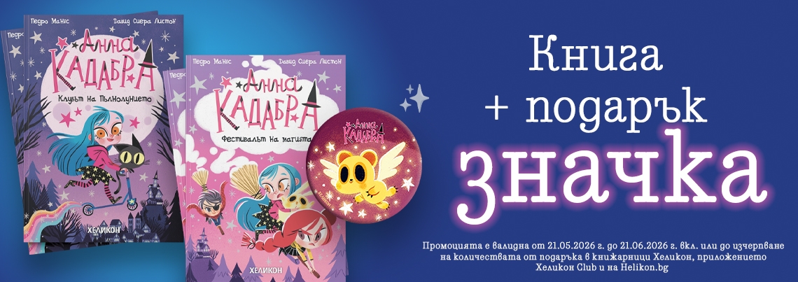
Анна Кадабра 8: Фестивалът на магията
Педро Маняс и Давид Сиера Листон
11.95 € / 23.37 ЛВ.

Рейтингът се формира от продажбите в системата на Хеликон
Кой е Кристиано Роналдо?
Джеймс Бъкли-младши и Грегъри Копланд
8.50 € / 16.62 ЛВ.

Рейтингът се формира от продажбите в системата на Хеликон
Изадора Муун отива в лунапарка - Книга 7
Хариет Мънкастър
10.50 € / 20.54 ЛВ.

Рейтингът се формира от продажбите в системата на Хеликон
Дивият Джак - бр. 6 Срещу глутницата
Мис Прикли и Кид Тусен
10.50 € / 20.54 ЛВ.

Рейтингът се формира от продажбите в системата на Хеликон
Мисия „Кексче“. Как работят простите механизми
Бамби Едлунд
13.95 € / 27.28 ЛВ.

Рейтингът се формира от продажбите в системата на Хеликон
Приключенията на Пинокио / Луксозно издание с илюстрации на Ясен Гюзелев
Карло Колоди
20.43 € / 39.96 ЛВ.


Рейтингът се формира от продажбите в системата на Хеликон
Деца играят вън
Георги Данаилов
7.95 € / 15.55 ЛВ.

Рейтингът се формира от продажбите в системата на Хеликон
Приключенията на Том Сойер
Марк Твен
6.95 € / 13.59 ЛВ.

Рейтингът се формира от продажбите в системата на Хеликон
Автобиография
Бранислав Нушич
5.95 € / 11.64 ЛВ.

Рейтингът се формира от продажбите в системата на Хеликон
100 умни игри за здравето - Активни карти
9.50 € / 18.58 ЛВ.

Рейтингът се формира от продажбите в системата на Хеликон
100 Умни кръстословици - Активни карти
8.64 € / 16.90 ЛВ.

Рейтингът се формира от продажбите в системата на Хеликон
Мозъчни битки/ Активни карти + маркер
8.64 € / 16.90 ЛВ.

Рейтингът се формира от продажбите в системата на Хеликон
100 игри за деца на път/ Активни карти, изтриваеми с маркер
8.64 € / 16.90 ЛВ.

Рейтингът се формира от продажбите в системата на Хеликон
100 игри с приказни герои/ Активни карти изтриваеми с маркер
8.64 € / 16.90 ЛВ.

Рейтингът се формира от продажбите в системата на Хеликон
Още 100 игри за деца на път/ 50 изтриваеми карти с маркер
8.64 € / 16.90 ЛВ.

Рейтингът се формира от продажбите в системата на Хеликон
Игри и загадки за големи деца/ Активни карти
8.64 € / 16.90 ЛВ.

Рейтингът се формира от продажбите в системата на Хеликон
100 игри за света и буквите/ Активни карти, изтриваеми с маркер
8.64 € / 16.90 ЛВ.

Рейтингът се формира от продажбите в системата на Хеликон
100 игри за природата и числата/ Активни карти
8.64 € / 16.90 ЛВ.

Рейтингът се формира от продажбите в системата на Хеликон
Логически загадки/ Активни карти, изтриваеми с маркер
8.64 € / 16.90 ЛВ.

Рейтингът се формира от продажбите в системата на Хеликон
Нищо за губене
Джонатан Ангелов
12.90 € / 25.23 ЛВ.


Рейтингът се формира от продажбите в системата на Хеликон
Справихме се, хлапе
Антъни Хопкинс
14.00 € / 27.38 ЛВ.

Рейтингът се формира от продажбите в системата на Хеликон
Не може да ме нарани
Дейвид Гогинс
15.29 € / 29.90 ЛВ.

Рейтингът се формира от продажбите в системата на Хеликон
Картие. Мечтата за диаманти
Софи Вияр
14.30 € / 27.97 ЛВ.
-10%

Рейтингът се формира от продажбите в системата на Хеликон
Непокорните диви
Кристина Морато
12.78 € / 25.00 ЛВ.
Отстъпка -10%
Отстъпка -10%
11.50 € / 22.49 ЛВ.

Рейтингът се формира от продажбите в системата на Хеликон
Мерил Стрийп (Винаги тя)
Майкъл Шулман
12.99 € / 25.41 ЛВ.
-10%

Рейтингът се формира от продажбите в системата на Хеликон
Прокълнатите кралици
Кристина Морато
12.78 € / 25.00 ЛВ.
Отстъпка -10%
Отстъпка -10%
11.50 € / 22.49 ЛВ.

Рейтингът се формира от продажбите в системата на Хеликон
Джордж Лукас
Брайън Джоунс
12.27 € / 24.00 ЛВ.
-30%

Рейтингът се формира от продажбите в системата на Хеликон
Барбра Стрейзанд
Нийл Гейблър
9.20 € / 17.99 ЛВ.
Отстъпка -30%
Отстъпка -30%
6.44 € / 12.60 ЛВ.

Рейтингът се формира от продажбите в системата на Хеликон
Алеа Аквариус: Повикът на водата
Таня Щевнер
8.64 € / 16.90 ЛВ.

Рейтингът се формира от продажбите в системата на Хеликон
Алеа Аквариус: Цветовете на морето
Таня Щевнер
8.64 € / 16.90 ЛВ.

Рейтингът се формира от продажбите в системата на Хеликон
Алеа Аквариус: Тайната на океаните
Таня Щевнер
10.17 € / 19.89 ЛВ.

Рейтингът се формира от продажбите в системата на Хеликон
Алеа Аквариус: Посланието на дъжда
Таня Щевнер
8.64 € / 16.90 ЛВ.

Рейтингът се формира от продажбите в системата на Хеликон
Алеа Аквариус: Реката на забравата
Таня Щевнер
11.25 € / 22.00 ЛВ.

Рейтингът се формира от продажбите в системата на Хеликон
Алеа Аквариус: Могъщи приливи и отливи
Таня Щевнер
10.17 € / 19.89 ЛВ.

Рейтингът се формира от продажбите в системата на Хеликон
Алеа Аквариус: Магията на клетвата
Таня Щевнер
10.23 € / 20.01 ЛВ.

Рейтингът се формира от продажбите в системата на Хеликон
Алеа Аквариус: Вълните на времето
Таня Щевнер
11.25 € / 22.00 ЛВ.

Рейтингът се формира от продажбите в системата на Хеликон
Алеа Аквариус: Песента на китовете
Таня Щевнер
13.29 € / 25.99 ЛВ.

Рейтингът се формира от продажбите в системата на Хеликон
Алеа Аквариус: Звезда на съдбата
Таня Щевнер
12.50 € / 24.45 ЛВ.

Рейтингът се формира от продажбите в системата на Хеликон
Рухнала жена
Колийн Хувър
10.70 € / 20.93 ЛВ.

Рейтингът се формира от продажбите в системата на Хеликон
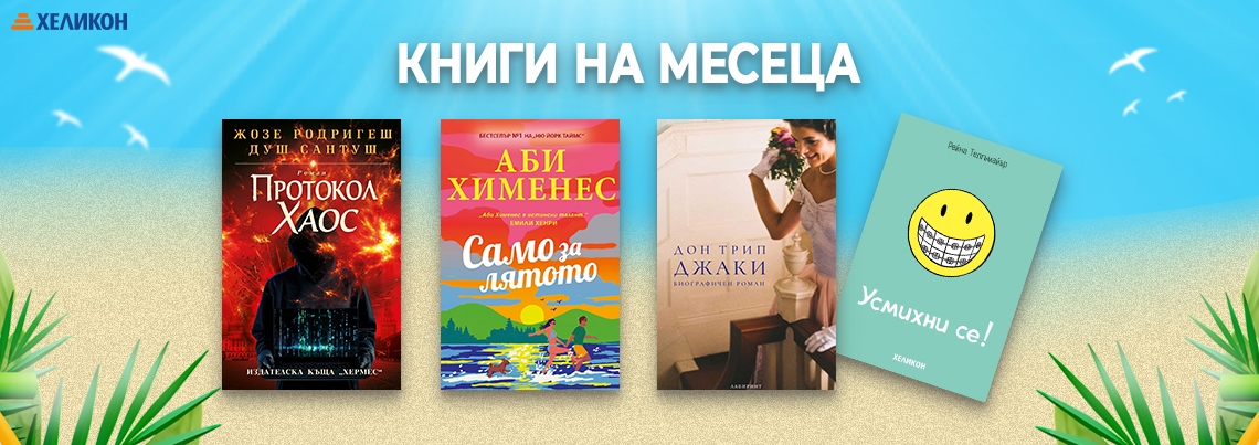
Протокол "Хаос"
Жозе Родригеш душ Сантуш
12.95 € / 25.33 ЛВ.

Рейтингът се формира от продажбите в системата на Хеликон
Джобна енциклопедия на суперхраните
Радослав Пламенов
14.99 € / 29.32 ЛВ.

Рейтингът се формира от продажбите в системата на Хеликон
Музика на случайността (ново издание)
Пол Остър
12.00 € / 23.47 ЛВ.

Рейтингът се формира от продажбите в системата на Хеликон
Горещо какао всеки четвъртък
Мичико Аояма
12.00 € / 23.47 ЛВ.

Рейтингът се формира от продажбите в системата на Хеликон
Братя Карамазови Т.1
Фьодор М. Достоевски
12.00 € / 23.47 ЛВ.


Рейтингът се формира от продажбите в системата на Хеликон
ПРИНЦЕСА. Cosy Colouring
4.99 € / 9.76 ЛВ.

Рейтингът се формира от продажбите в системата на Хеликон
ЖИВОТИНКИ. Cosy Colouring
4.99 € / 9.76 ЛВ.

Рейтингът се формира от продажбите в системата на Хеликон
ДОБРИ ПРИЯТЕЛИ. Cosy Colouring
4.99 € / 9.76 ЛВ.

Рейтингът се формира от продажбите в системата на Хеликон
Остайница
Рене Карабаш
10.90 € / 21.32 ЛВ.

Рейтингът се формира от продажбите в системата на Хеликон
Един по един
Фрида Макфадън
12.99 € / 25.41 ЛВ.

Рейтингът се формира от продажбите в системата на Хеликон
Палачинкова къща „Строубъри Пач“ (с цветни порезки)
Лори Гилмор
11.00 € / 21.51 ЛВ.

Рейтингът се формира от продажбите в системата на Хеликон
Силата на наричането. Тайната на думите и древните български обичаи, които сбъдват желания
Мирослава Митева
12.90 € / 25.23 ЛВ.
Рейтингът се формира от продажбите в системата на Хеликон
Нищо за губене
Джонатан Ангелов
12.90 € / 25.23 ЛВ.

Рейтингът се формира от продажбите в системата на Хеликон
Бягащата с вълци. Инстинктивната природа на жените
Клариса Пинкола Естес
12.78 € / 25.00 ЛВ.

Рейтингът се формира от продажбите в системата на Хеликон
Избрани творби/Христо Ботев
Христо Ботев
3.35 € / 6.55 ЛВ.

Рейтингът се формира от продажбите в системата на Хеликон
Приключенията на Незнайко
Николай Носов
3.04 € / 5.95 ЛВ.

Рейтингът се формира от продажбите в системата на Хеликон
Старогръцки митове и легенди
Николай Кун
3.04 € / 5.95 ЛВ.

Рейтингът се формира от продажбите в системата на Хеликон
Басни/ Лафонтен
Лафонтен
2.53 € / 4.95 ЛВ.

Рейтингът се формира от продажбите в системата на Хеликон
Не на мене тия
Харлан Коубън
14.00 € / 27.38 ЛВ.

Рейтингът се формира от продажбите в системата на Хеликон
Магазинчето на Хидън Лейн
Джейн Ан Кренц
11.95 € / 23.37 ЛВ.

Рейтингът се формира от продажбите в системата на Хеликон
Живей сега!
Ерик Бертран Ларсен
10.00 € / 19.56 ЛВ.

Рейтингът се формира от продажбите в системата на Хеликон
Една нощ в шатото
Вероника Хенри
12.99 € / 25.41 ЛВ.

Рейтингът се формира от продажбите в системата на Хеликон
Сребърен елит /с цветни порезки/
Дани Франсис
19.00 € / 37.16 ЛВ.

Рейтингът се формира от продажбите в системата на Хеликон
The Mysterious Uzbekistan
Lubomir Getov
20.00 € / 39.12 ЛВ.

Рейтингът се формира от продажбите в системата на Хеликон
Завърти и научи: форми
Колектив
5.99 € / 11.72 ЛВ.

Рейтингът се формира от продажбите в системата на Хеликон
Завърти и научи: цветове
Колектив
5.99 € / 11.72 ЛВ.

Рейтингът се формира от продажбите в системата на Хеликон
Завърти и научи: цифри
Колектив
5.99 € / 11.72 ЛВ.

Рейтингът се формира от продажбите в системата на Хеликон